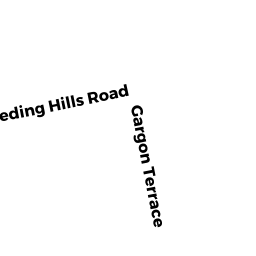
19 GARGON TERR
Owner Information
SJOSTROM MARVIN N
19 GARGON TERR
SOUTHWICK, MA 01077


Property Details
19 GARGON TERR is classified as a Single Family Residential (Conventional).
The primary structure on this property was built in 1955. There are 3,526ft2 of built area within this property. There is 1,446ft2 of residential/living space within this property. This property is listed as having 7 rooms.
19 GARGON TERR is valued at $261,500. The land is valued at $73,200 and the structures are valued at $186,600. There is an additional valuation of $1,700 on this property.
This property is in Zone R-20A. Confirm with local Zoning Board authorities to ensure there are no overlays or other easements on this property.
The most recent deed for 19 GARGON TERR is recorded at the local registrar in Book 12457, Page 0470. 19 GARGON TERR was last sold on Wednesday, July 24, 2002 for $1.
Assessment data from fiscal year 2022.
Flood Data
According to the FEMA National Flood Hazard Layer, this property does not appear to be in a flood zone. It may also be in an area not yet reviewed. Nonetheless, confirm this information prior to taking any action.
To view the flood hazards around this property, create a FEMA "Firmette" Map of the area around 19 GARGON TERR.
Broadband Internet Providers
| Provider | Type | Bandwidth (mbps) | |
|---|---|---|---|
| Comcast | Cable | 1000 | 35 |
| GCI Communication Corp. | Satellite | 0 | 0 |
| Viasat Inc | Satellite | 35 | 3 |
| Verizon New England Inc. | DSL | 10 | 1 |
| VSAT Systems, LLC. | Satellite | 2 | 1 |
| HughesNet | Satellite | 25 | 3 |
Broadband service provider data from December 2020.
Adjacent Properties
- 21 R GARGON TERR
Undevelopable Residential Land owned by COOK II LEROY B - 19 R GARGON TERR
Undevelopable Residential Land owned by SJOSTROM MARVIN N - 17 R GARGON TERR
Undevelopable Residential Land owned by HERBERT JUSTIN M - 17 GARGON TERR
Single Family Residential owned by HERBERT JUSTIN M - 21 GARGON TERR
Single Family Residential owned by COOK II LEROY B